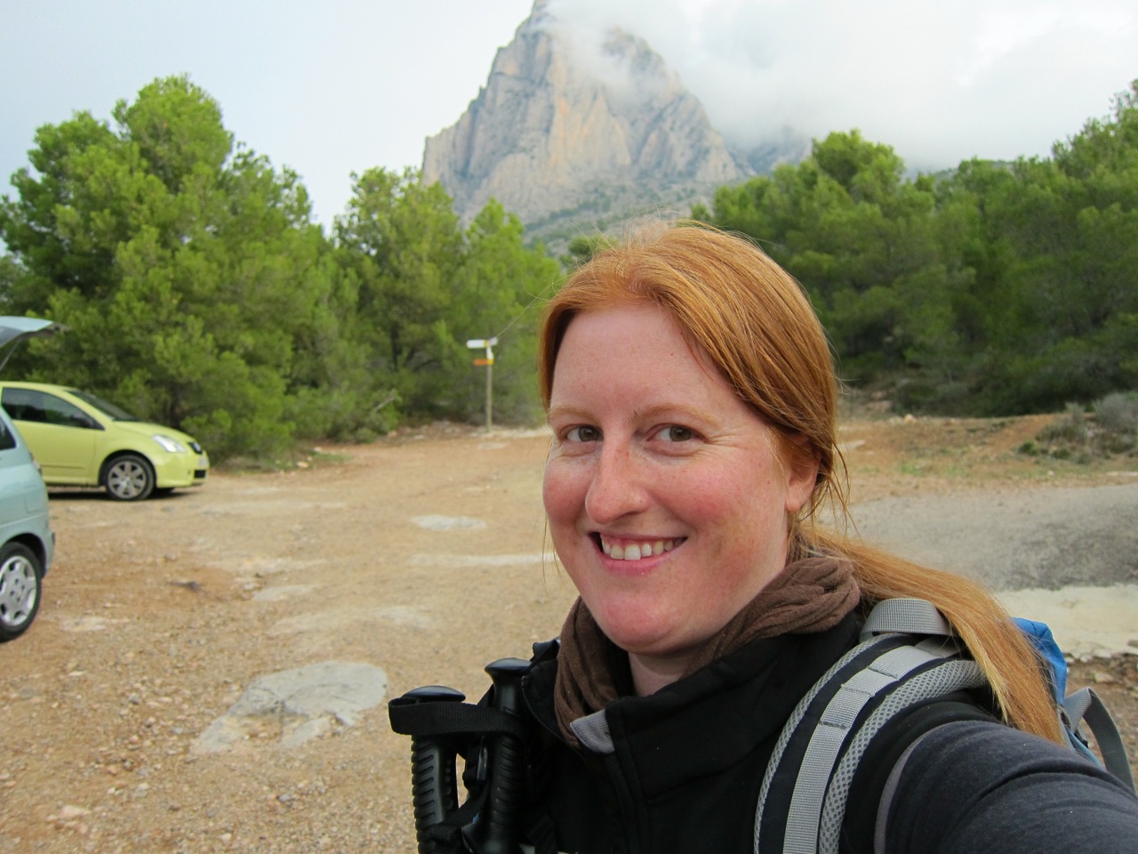
So last Sunday was THE hike, the one I've been kind of worried about all season since I saw it on the Centro Excursionista's calendar of activities: hiking up the Puig Campana, Alicante's second highest peak (1410m above sea level, ~ 4625 ft). Possibly the toughest hike you can do in this province (at least that's what I'm told). Anybody who's visited the northern coast of Alicante (or driven down the AP-7 on their way north or south) has seen this mountain, it's very recognisable. For starters it's big. Kind of dominates the highway and the view back behind Benidorm. Then there's that big cube-shaped hole in it. Seriously! See for yourselves:
 |
| Puig Campana behind Benidorm, seen from the island |
I won't go into the various and sundry legends as to how that happened (a kick from a giant, Roland slicing it with his sword...), I'll just tell you that they all end up with the missing mountain chunk flying through the air and ending up in the bay just in front of Benidorm (and geologists say the shape and type and age of the rocks are a good fit).
In any case, it's a mountain that I've been conscious of since my earliest visits to Alicante in childhood, and one that I rarely gave any thought of hiking up because I've always been told it's very gruelling and difficult.
 |
| still not convinced I want to do this in my present physical condition (or lack thereof) |
Here's a map of the route so you can kind of have a visual in your mind of where we are as we go around. Basically we circled the mountain clockwise along the PRV-289, starting at the southern tip just above point 1. At point 4 we left the main track for the mountain peak track, and then returned down it to continuing the base circuit. All in all about 16 km (~ 10 miles) and a climb of about 1250 m (~ 4100 ft). I apologise in advance for the large number of photos, after several days of weeding through them I just couldn't bring myself to delete any more and still tell a full story! :p

So about 40 adventurous souls started out bright and early and a bit wary of the path ahead, which didn't start out easy at all! I guess it's not that surprising considering we had to climb 600m in just 5km (so ~ 2000 ft in 3 mi). Fortunately the effort kept us warm, 'cause it was quite cool in the shade of the mountain! But the views (looking north and west) were fabulous! Gorgeous light and just enough clouds to make the sky interesting:

More worrisome was the cloud that had been sitting on the mountain-top ever since we arrived! It slowly started to move away, but would it be gone by the time we made it up? Here you can just make out the back side of that cubic hole:

After an hour or so of steady climbing (with stops for water and to strip layers when the sun came out. T-shirts in December? Check!), we made it to our mid-morning snack stop: a small shelter built once upon a time by some of the "oldies" in the Centre (you should hear one guy's war stories about lugging the construction material up there!). Upon arrival we actually woke up a group of hikers who had spent the night there! :p

After the break we had another half hour of steady climbing to the Coll del Pouet (point 4 on that map), the spot where we'd either head up to the top or wait around for those who did. Everyone decided to try the climb. Check me out! My face is a perfect match to this girl's pants! lol!

As one guy said "Hemos hecho lo duro, ahora viene lo peor" (transl: "we've done the hard part, now comes the worse part!"). We were going to have to climb 350m in under 2km (1150ft in 1.2mi) to reach the Bancal del Moro, the cleft you can see in the centre of this next shot:

Fortunately the path has been worked on by local hiking groups over the years, so most of it was in nice zig-zags like these:

Were it not for their hard work we'd have to be dealing with climbing up stuff like this:

Up, up and up... One. Step. At. A. Time. BREATHE!!! And then another step. As we climbed the views kept getting better and better, and the clouds just came and went changing the scenery every couple of minutes. Sometimes it felt like I could reach out and touch them!


I spent most of the climb keeping an eye on our youngest member who was an amazing trouper and didn't complain once in that climb! Here she almost at the top, she'd stop every once in a while to show me the "elf holes" she found in the ground (which she'd made with my walking stick):

An hour of climb, climb, climb... to finally rest a bit in the sunshine up on the Bancal del Moro. Is it any wonder my face is really red? :D

But a breather's all you get... there's still about 100m left to climb to reach the summit!

So on we go, into the cloud that has decided to settle itself on the peak. Don't get lost!

VICTORY!!!!
 |
| On the summit of the Puig Campana, 1410m above sea level |
Gazing back south along the ridge of the Puig Campana:

and the amazing views of the Aitana and other mountains to the west:

But where's the sea?! Looking this way we should see these fabulous views of Benidorm, Altea, the Peñón d'Ifach, even Alicante or as far off as Ibiza!!! Damn cloud...

Oh well, I guess I'll have to go back up another time, huh? ;o)
This was kind of a Christmas hike (you'll see why in a sec), and our fearless leader had brought up a bottle of Cava (Spanish champagne) with him!!! Congratulations to making it up here, and MERRY CHRISTMAS!


Pol and I enjoyed our well-deserved drink! ;o)
And here's the Christmas element: the objective of this hike was to put a crèche or Nativity Scene up on the mountain top!


Someone will be back in March to pick it up (if it's still there). Had the weather allowed, the plan was to have lunch up there and sing Christmas carols etc... but it's cold and windy in that cloud! So back down to the more protected Bancal del Moro to eat our sandwiches.

But wouldn't you know... the moment you start down is when the clouds start to clear!!! Here's a glimpse of Benidorm that I could just begin to make out through the clouds:

After lunch it was time to get back on our tired legs and hope they'd hold steady on the trek down. Yup, the problem with hiking is that everything that goes up must come down! And this down was much more dangerous than the up! This shot will give you a much better idea than any of the "going up" ones did about how steep this path was:

And all those little rocks made it very difficult to get a solid footing! There were quite a few slips, but fortunately nothing serious.
Back down in the forest and those damn clouds decided to grant us the gift of a little rain! Argh!!! Oh well, I've finally found a use for my rain jacket! :p

Once everyone had made it down, we continued clockwise along the trek around the mountain, continuing through what used to be a pine forest (sadly burnt to a crips in a massive forest fire several years ago).

At the beginning we stuck close to the wall of the mountain, looking up and seeing only rock, like at the Font de la Solsida here:

A little spring that some volunteers fixed up so there would be a spot with water accumulation so animals could drink.

As we walked on, I got to thinking that if it weren't for the pine cones I could almost imagine these were de-leaved winter trees and not burnt pines...

They made for a poignant landscape... out of which Benidorm suddenly appeared!

 |
| flat sea... perfect day for scuba diving! ;o) |
And the Sierra Helada, the hardest hike I'd done here in Alicante, until now:

We may have left the hard climb behind us, but this circuit had its tough spots as well where you had to watch where you put your feet and not loose sight of the markers:

And once we'd gotten over that ridge, a new challenge! Walking with the sun in your eyes!

Some people preferred the mountain views on the other side, I was just as fascinated by the changing dynamic of the rolling mountainside with the various towns and the Mediterranean behind it! And noticing the difference in vegetation (no trees!) on this sunnier side.

Aha! Finally a decent look at this mountain! First time we get a good view of that cubic hole!

I still couldn't quite believe I'd made it up there...

We moved into the trees, and I kept looking up to spot that cube...

What's this? A cave-house? La Cova del Cremat, "the Burnt Cave"?. Looks like someone built a corral in front of a cave.

Quite cosy inside!

Finally rounding the southern tip and facing west again as the sun slowly starts setting, giving us more gorgeous views.

I usually dislike finding myself on a paved road, but when we hit this spot I rejoiced because it meant we were almost back at the cars and could finally REST! ;o)

Was an AMAZING hike and I'm so glad I did it! I definitely wasn't in good enough shape yet to do it comfortably, but one step at a time and easy does it gets you to the top! And I wasn't even the last one up there, so YES! :o)
Um, Cris? I would LOVE to read this post when I have time to go through all 46 pictures and read it all... but it's going to have to wait for another day! Looks like it was a great hike anyway.
ReplyDeleteAWESOME!!! Fantastic pictures and what a hike. SO much to comment on - which do I like best? The Victory photo of you at the top is awesome. All the views - superb! Love seeing Pol with you and his little red cap is so cute. I really liked the shot of the walk down showing how steep it was. Amazing! Don't you love the camaraderie of all the hikers? Great post!!
ReplyDeleteDJan, I know... like I said I had trouble bringing the number down lower! I hope you have time (and remember!) sometime in the future! ;o)
ReplyDeleteKim: THANKS! I'm so proud of having made it up there, so yeah, I really like that Victory photo too! But next time I'm going have Pol drag me up instead of the opposite. After all, he's got 8 legs and I've only got 2! You'd think it would be easier for him! :p
See, that's just the thing. All the good stuff is up high. The cool part is once you've done it, it gets easier fast. (Corollary is that all that fitness goes away in a hurry too...) I still remember a grueling 2500 ft in 2.5 miles that I did last year, just like your steepest part here, and I only had enough breath to swear loudly at anyone foolish enough to talk to me. It was AWFUL. But as long as things aren't quite that steep, I'd join you in a heartbeat (however elevated). GOOD FOR YOU! The smiles tell all.
ReplyDeleteMurr, you're almost right! MOST of the good stuff is up high! I've done some fabulous hikes that didn't require such a climb... but then they didn't make me feel as good after ;o)
ReplyDeleteTalking and climbing? How do people find the breath for that! Not me! :p
Thanks for sharing the map! We are heading up on Friday. :D
ReplyDeleteEnjoy!!! And be sure to take warm clothes for the summit and plenty of water! ;)
Delete